by Juan Wilson on 29 November 2006
The Kauai County Website (http://www.kauai.gov/) has two wonderful services that are very useful for people interested in planning on Kauai.
They are Kauai County GIS Tools (http://www.kauai.gov/default.aspx?tabid=433)
and currently have two GIS databases.
One is the State of Hawaii's Kauai County Online GIS
http://gis.hawaii.gov/website/kauaicty/viewer.htm
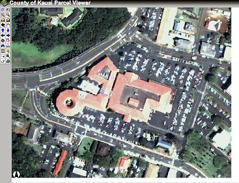
This database displays all property parcel boundaries. When zoomed in close the boundaries are over layed aerial digital photography as well as street names and property addresses. Note that the aerial digital images are offset slightly from the property boundaries. This is particularly annoying with small parcels.
It should also be noted that these digital images are about the best available covering the interior of the island of Kauai that I have found availble for free on the internet.
The Second is the Kauai Online Hazard Assessment Tool
http://csc-s-maps-q.csc.noaa.gov/khat/viewer.html
This database includes maps of various flood hazard area as well as tsunami evacuation areas. This data is also displayed over the same digital aerial photo images as the parcel boundaries. Note that there are some false color issues in the photo images (many red roofs appear blue, for example).
They appear to operate on the same online engine as
the Kauai Benthic Habitat Viewer
(http://egisws01.nos.noaa.gov/website/biogeo/HI_Kauai/viewer.htm)
With both GIS tools there are layers and features that allow many ways to display data, measure distances and control scale and detail. With some experimentation these tools are very useful. Enjoy!
|